
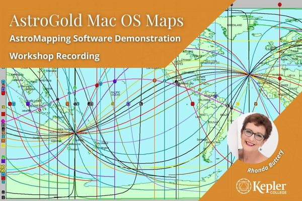
Exploring AstroGold Mac Maps function, your Astro*Carto*Graphy and Local Space tool, including:
- Zoomable/pannable world maps in two styles - satellite and map
- Selectable display of country and major city names
- Display of MC/IC/Rise/Set and Local Direction lines - choice of Zodiacal versus In Mundo
- Pop-up interpretations for all line annotations
- Chart relocation options for local lines
- PDF relocation interpretations report for any user-selected location
- Angular distance measuring tool by using mouse click and drag
- Various image share options
- Display parans and aspects*
- Displaying a local space image onto a google map.
- Teacher: Rhonda Buttery